Earth Wind+RH Map Animated 1000mbแผนภาพทิศทางลม+ความแรงลม เคลื่อนไหวที่ระดับความสูง Mean Sea Levelน้ำทะเลปานกลาง 364 ฟุต (1000 hpa)'Earth,' animated online realtime map of global weather conditions, is beautiful and awesome-ncep.noaa.gov |
Earth Wind+RH Map Animated 850mbแผนภาพทิศทางลม+ความความแรง เคลื่อนไหวที่ระดับความสูง 5,000 ฟุต (850 hpa)'Earth,' animated online realtime map of global weather conditions, is beautiful and awesome-ncep.noaa.gov |
Earth Wind+Speed Map Animated 750mbแผนภาพทิศทางลม+ความแรง เคลื่อนไหวที่ระดับความสูง 8,000 ฟุต (750 hpa)GFS forecast model, produced by NOAA, is the major source of weather data. Forecast data are updated four times a day and in detailed zoom |
แผนภาพทิศทางลม+ความชื้นสัมพัทธ์ เคลื่อนไหวที่ระดับความสูง 10,000 ฟุต (700 hpa)'Earth,' animated online realtime map of global weather conditions, is beautiful and awesome-ncep.noaa.gov |
Steering Layer 700-850mb/high-density,multispectral satellite-derived windแผนภาพทิศทางการไหลและเคลื่อนตัวของเมฆฝนระดับความสูง 5,000-10,000 ฟุต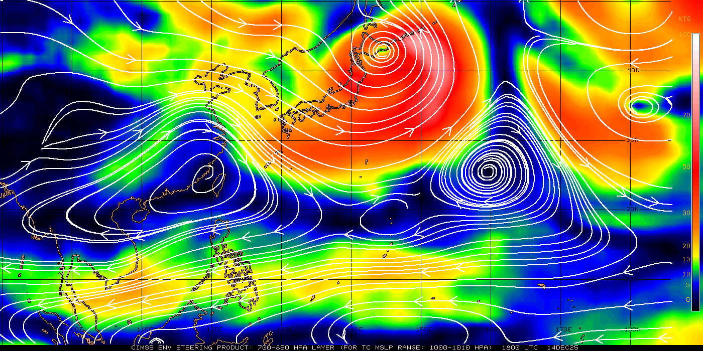
|
Steering Layer 500-850mb/high-density,multispectral satellite-derived windแผนภาพทิศทางการไหลและเคลื่อนตัวของเมฆฝนระดับความสูง 5,000-20,000 ฟุต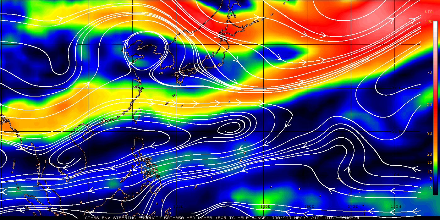
|
Numerical Weather Prediction Product From Japan Model 925mbแบบจำลองพยากรณ์อากาศทิศทางลมระดับความสูง 1,900 ฟุต /925 mb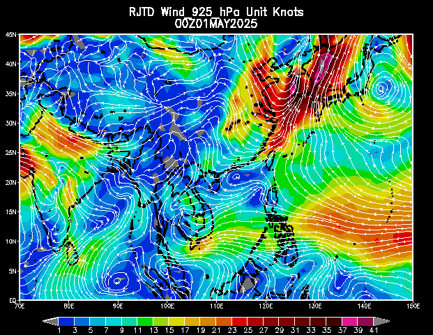
|
Numerical Weather Prediction Product From Japan Model 850mbแบบจำลองพยากรณ์อากาศทิศทางลมระดับความสูง 5,000 ฟุต /850 mb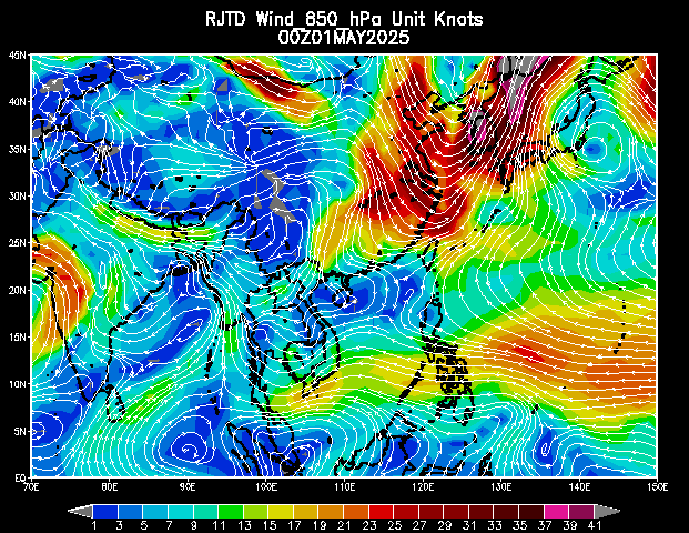
|
Numerical Weather Prediction Product From Japan Model 500mbแบบจำลองพยากรณ์อากาศทิศทางลมระดับความสูง 20,000 ฟุต /500 mb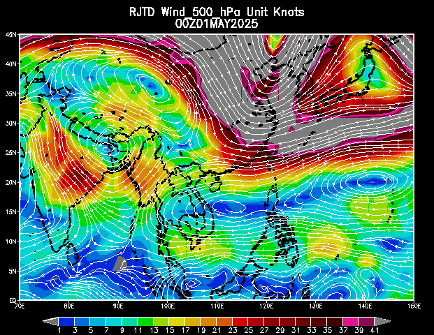
|
Wind
สมัครสมาชิก:
ความคิดเห็น (Atom)


ขอบคุณสำหรับข้อมูลที่มีประโยชน์หลากหลายครับ
ตอบลบช่วยได้เยอะเลยครับ มีประโยชน์มาก
ตอบลบ